Deploying real-time conservation technology in Ecuador’s Amazon and cloud forests, in partnership with the communities who have protected them for centuries.
There are places in Ecuador where the canopy closes above you and the sky disappears. Where rivers carve through primary forest that has never been logged, never been mapped by satellite in any meaningful detail, never been seen by anyone other than the people who have called it home for generations. The Achuar know these forests the way you know the rooms of your house. They walk them in darkness. They read them by sound. They have protected them not through policy or legislation, but through presence, through a relationship with the land so deeply woven into daily life that the idea of separating the two would make no sense at all.
And yet the threats arrive anyway. Illegal logging crews push deeper each year into territories that exist on no company’s concession map. Oil exploration knocks at the borders. The sounds of chainsaws carry across rivers that once carried only birdsong. The Achuar monitor their territory on foot, sometimes walking for days to confirm what they already suspected. By the time evidence reaches anyone who can act on it, the damage is done.
This is the gap that technology was meant to close. Not the technology of extraction, which has arrived in the Amazon with devastating efficiency, but the technology of witness. Of watching. Of knowing what is happening in real time, across vast and roadless landscapes, and placing that knowledge directly in the hands of the people who need it most.
The Sharamentsa Deployment
In partnership with the Achuar community of Sharamentsa, Geologic Dome is deploying two dome systems into the heart of Achuar territory in the Ecuadorian Amazon. Sharamentsa is a community of roughly 100 people, surrounded by some of Ecuador’s largest untapped oil reserves and nearly 25,000 acres of primary rainforest that the community has committed to protecting under a forest stewardship agreement. They have been trained in GPS, drone mapping, and satellite monitoring. They are not passive recipients of conservation aid. They are the conservation infrastructure.
What they have lacked, until now, is persistent eyes. A system that does not sleep, does not need to walk for three days to reach a logging incursion, does not rely on quarterly satellite passes to detect change. The domes provide exactly that. Placed in strategic locations across the territory, they deliver continuous, 360-degree monitoring connected via Starlink satellite. AI running onboard distinguishes between wildlife movement, human activity, and vehicles, and sends real-time alerts directly to community monitors and park rangers.
But the deployment is not only about threat detection. It is about understanding what lives in these forests with a depth and continuity that has never been possible before.
Reading the Canopy, Reading the Ground
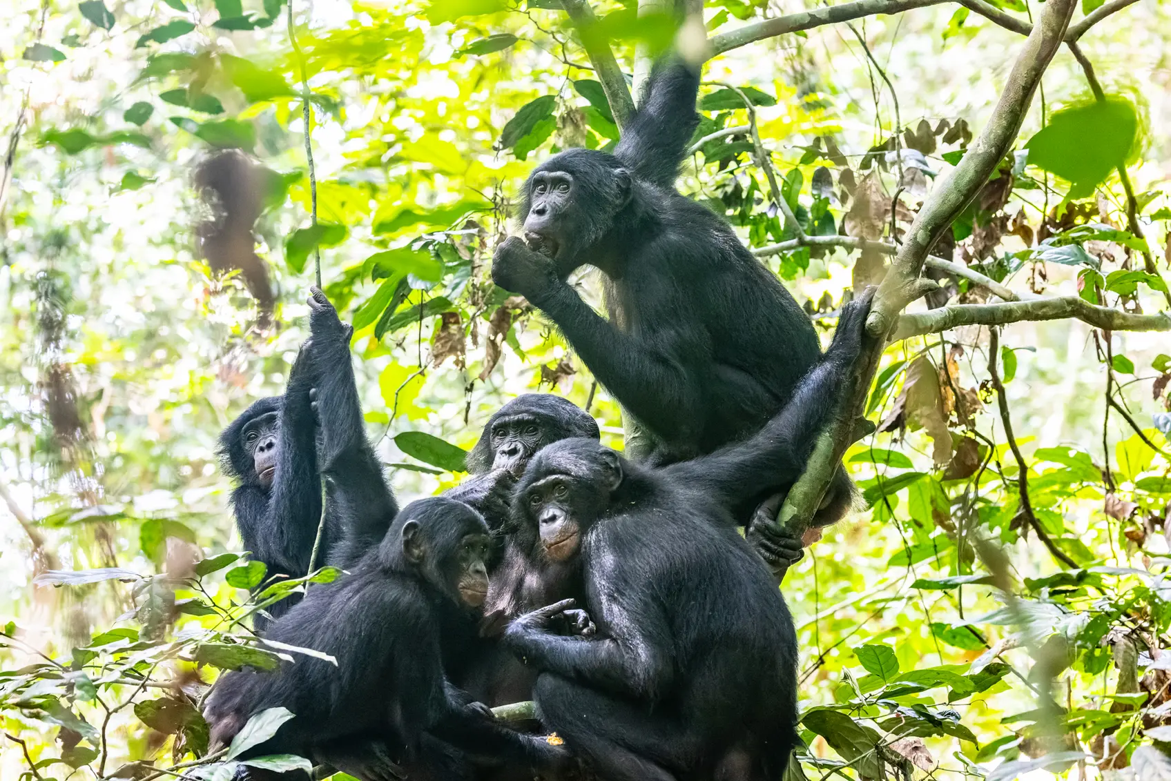
Ecuador is one of the most biodiverse countries on Earth. Within the span of a few hundred kilometers, the landscape shifts from lowland Amazon rainforest to Andean cloud forest, each ecosystem holding species found nowhere else. Traditional camera traps have been the standard tool for decades, but they capture fragments. A single angle. A single height. A trigger that fires when something walks past, and misses everything that flies above, crawls below, or simply pauses outside the frame.
The dome systems operate differently. In the Amazon, cameras are placed both high in the canopy and along terrestrial wildlife trails, capturing the full vertical spectrum of the forest. Arboreal species that traditional traps miss entirely, primates moving through the upper canopy, birds nesting in the mid-story, the slow passage of a sloth across a branch at dawn, all of it falls within the field of view. On the ground, the same system tracks terrestrial fauna along corridors that camera traps would cover only in isolated snapshots.
In Ecuador’s cloud forests, a parallel deployment tests the system at bird feeders near research stations and ecolodges. Cloud forest birds are among the most sought-after species for both researchers and ecotourists, yet identification remains manual, slow, and dependent on expertise that is not always available on site. The domes train AI models on species identification in real time, building datasets that improve with every hour of operation. What begins as a monitoring tool becomes, over time, a living field guide, available to researchers, lodge operators, and visitors alike.
What We Are Learning
This is not a laboratory trial. It is a field deployment under the most demanding conditions conservation technology will ever face. Humidity that corrodes electronics. Canopy cover that challenges satellite connectivity. Terrain that makes maintenance visits a multi-day commitment. If the system works here, it works anywhere.
We are testing whether continuous AI-powered monitoring detects more species across more habitat layers than traditional camera traps. Whether live feeds remain reliable under jungle and cloud forest conditions. Whether the AI can distinguish significant movement from background noise, separate wildlife from humans from vehicles, identify species, and eventually recognize distinct individuals within a species. Whether storage, upload, and notification systems perform under bandwidth constraints that would cripple conventional approaches. Whether the long-term operational cost falls below what conventional monitoring demands.
And, perhaps most importantly, whether the data reaches the right people in time for it to matter.
Closing the Gap Between Knowing and Acting
Conservation has been limited for decades by the same structural problem: delayed data, sparse coverage, and high costs. Researchers spend months in the field collecting observations that take additional months to process. By the time a study is published, the forest it describes may already be smaller. Rangers patrol vast territories on foot, relying on intuition and incomplete information. Communities report incursions through channels that move at the speed of bureaucracy while chainsaws move at the speed of commerce.
The Sharamentsa deployment is designed to collapse that timeline. When a logging crew enters the territory, the alert arrives in minutes, not weeks. When a jaguar crosses a monitored trail, the sighting is logged, geotagged, and added to a species inventory automatically. When bonobo nesting patterns shift in Salonga or bird populations fluctuate in Ecuador’s cloud forests, the data is there, continuously updated, ready to inform decisions before the window for action closes.
Starlink makes this possible by eliminating the connectivity barrier that has kept remote ecosystems in a data blackout. Edge AI makes it useful by processing footage locally, sending only what matters, and learning from every frame. Together, they represent an inflection point. Not a marginal improvement over camera traps, but a fundamentally different relationship between conservation and information.
Technology in Service of Those Who Steward the Land
There is a version of this story where technology arrives in the Amazon as it usually does: designed elsewhere, deployed without consultation, extracting data that flows outward to institutions and never returns. That is not this project.
The Achuar community of Sharamentsa is not a test site. They are partners. The monitoring system is accessible to them through a voice-based mobile interface that Geologic Dome built specifically for communities where where knowledge and traditions is passed down orally and screen-based interaction is not the default. Community members can speak to the app to check camera feeds, view a map of their territory, browse a gallery of captured wildlife, and receive alerts, all without needing to read or type. The data belongs to the territory. The knowledge stays with the people who need it.
Community members have described the system simply: it lets them protect his territory by speaking into his phone. The cameras see what his people cannot reach on foot. The AI processes what would take researchers months to analyze. And the education program built into the app delivers ecological knowledge directly to community members, turning monitoring into learning and learning into stewardship.
The First Chapter of a Longer Story
Ecuador is the proving ground. The Amazon and cloud forest deployments together test the dome system across the full range of conditions it will face in future projects: dense canopy, high altitude, extreme humidity, limited access, and the human complexity of working alongside communities whose relationship with the land predates any conservation framework by centuries.
What we learn here will shape deployments across protected areas, indigenous territories, working landscapes, ecolodges, and research stations worldwide. The long-term vision is a global network of these systems delivering better data, faster decisions, and more equitable conservation outcomes, where technology supports both ecosystems and the people who steward them.
But the vision means nothing without the proof. And the proof begins in Sharamentsa, in a community of 100 people surrounded by 25,000 acres of forest they have sworn to protect, who now have a new set of eyes that never close.
Because the forest still speaks. The question has always been whether anyone is listening.